
Vancouver/CMEDIA: A newly updated DriveBC platform with reliable road and weather conditions on provincial highways is accessible to the people driving throughout British Columbia (BC) this summer.
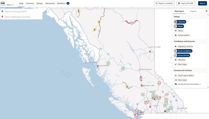
Featuring a simplified map and a cleaner, more intuitive design for desktop and mobile users, The new DriveBC platform’s new interactive map replaces the previous mobile text-based layout, offering a more visual, streamlined way to explore road conditions and updates.
While integrating provincial and regional travel advisories and bulletins, the platform also offers clearer updates on challenging weather conditions, emergencies and other events happening on provincial highways.
DriveBC’s improved route planning features would benefit the people facilitating them to focus on specific trips, save their favourite ones and receive customized notifications.
The upgraded highway webcams of this platform with a simpler layout enhanced features for faster access to real-time conditions.
To better support both the public and commercial drivers in making travel decisions, several new tools have been added including new detailed embedded information on border crossings, chain-up areas and inland ferries. More features are planned in the year ahead.
All feedback from user surveys, interviews, and consultation with the public, commercial drivers and stakeholders are used for updates which help the site continually improve, users will be able to provide ongoing feedback.
To help with the transition, users will still have access to the legacy site for a few months: https://legacy.drivebc.ca/