
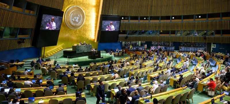
IBNS-CMEDIA: The UN General Assembly voted to replace the traditional map of Africa with a new one that accurately shows the continent’s size.
By 164 votes to one, Member States on Friday endorsed a resolution promoting map projections that more accurately reflect the true size of continents – the culmination of an African-led campaign against the 16th-century Mercator projection, still the most widely used map in the world.
The United States cast the sole vote against, dismissing the initiative as part of a “radical ideological project.”
Six countries – Estonia, Georgia, Lithuania, Moldova, Serbia and Ukraine – abstained.
The resolution does not ban the Mercator projection or impose a replacement. Instead, it encourages governments, schools, international organizations and technology companies to use the Equal Earth projection and other so-called equal-area maps when relative size matters, and to teach the limitations of any flat map in representing a spherical planet.
Behind that seemingly technical debate lies a larger argument about history and power: whether a map designed for European sailors in the 16th century has, over generations, distorted not only geography but perceptions of a whole, vast and complex continent.
“Maps shape our understanding of the world,” Robert Dussey, Togo’s foreign minister, said before the vote. “They guide education, nourish the imagination, and influence collective perceptions.”
Made small
Gerardus Mercator, a Flemish cartographer, devised his projection in 1569 to solve a practical problem of maritime navigation. Because straight lines on his map correspond to constant compass directions, sailors could use it to plot their courses.
But preserving direction came at the expense of area. Landmasses appear increasingly enlarged the farther they are from the Equator.
Greenland, for instance, can look roughly comparable in size to Africa, even though Africa is about 14 times larger. Northern Europe and North America are similarly magnified, relative to equatorial regions.
Despite its original navigational purpose, Mercator remains common in educational, media, digital and official materials. The resolution says those distortions have contributed to the “symbolic minimization” of Africa and perpetuated an unbalanced view of the world.
‘A fair map’
Togo led negotiations on behalf of the African group, building on a campaign backed by the African Union.
The resolution describes correcting such distortions as an act of “cognitive justice and memorial reparation” and points to Equal Earth, developed in 2018, as a projection that more accurately represents relative size.
Dussey emphasized that the effort was not meant to condemn Mercator, whose usefulness for navigation he acknowledged, or to impose a single projection.
“A fair map does not change the geography of the world, it changes how we see the world,” he said.
Washington objects
The United States saw something far more political in the effort.
“This resolution mocks the work and purpose of this institution,” the American representative said, arguing that what was presented as an innocuous attempt to update cartographic proportions was part of “the much larger and more radical ideological project it belongs to.”
The representative singled out the resolution’s references to reparations and “cognitive justice,” calling initiatives like it “barnacles on our work here and the reason this institution is losing its credibility.”
France moved in the opposite direction. Hours before the vote, Foreign Minister Jean-Noël Barrot announced Paris was planning to abandon Mercator for its maps of the world, aligning his Government with the broader effort championed by the African Union.
The shift means France itself, like the United States and Russia, will appear smaller relative to equatorial countries.
It illustrates the unusual dynamics of this decades-long debate. Equal-area maps do not make Africa larger; they remove the exaggeration Mercator gives landmasses closer to the poles.